Jorm (Jurm)
Jorm (also spelled Jurm) is a village in Badakhshan Province in north-eastern Afghanistan. The village is located on the left bank of the Kokcha River, about 7 miles upstream the junction with the Warduj River. Around the turn of the 20th century, it was described as being a large collection of scattered hamlets, with a population of at least 400 families, possibly much more.
The name Jorm is said to be derived from the fine Timur Lang placed on the villagers for an attack on his troops. The village proper lies on the left bank of the river, but its associated hamlets run 3 miles up and downstream from there on both banks. There was a large, ruined fort about one-half mile south of the village proper where the hakim of Jurm resided. He commanded the Yamgan-Warduj and Barak subdistricts.
Huts for those who graze their livestock can be found on both sides of the river up and down stream of Jurm. The location is highly regarded for its fruit and other vegetation, as well as for its fields and pastures. There was also a bazaar held there twice weekly, which specialized in whips.
Around the turn of the 20th century, there was a wooden bridge crossing the river at Jurm.
Jorm has a hot-summer humid continental climate (Köppen: Dsa) with hot, dry summers and cold, snowy winters.
Map - Jorm (Jurm)
Map
Country - Afghanistan
 |
 |
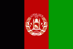
| Flag of Afghanistan | |
Human habitation in Afghanistan dates back to the Middle Paleolithic era, and the country's strategic location along the historic Silk Road has led it to being described, picturesquely, as the ‘roundabout of the ancient world’. Popularly referred to as the graveyard of empires, the land has historically been home to various peoples and has witnessed numerous military campaigns, including those by the Persians, Alexander the Great, the Maurya Empire, Arab Muslims, the Mongols, the British, the Soviet Union, and most recently by a US-led coalition. Afghanistan also served as the source from which the Greco-Bactrians and the Mughals, amongst others, rose to form major empires. The various conquests and periods in both the Iranian and Indian cultural spheres made the area a center for Zoroastrianism, Buddhism, Hinduism, and later Islam throughout history.
Currency / Language
| ISO | Currency | Symbol | Significant figures |
|---|---|---|---|
| AFN | Afghan afghani | Ø‹ | 2 |
| ISO | Language |
|---|---|
| PS | Pashto language |
| FA | Persian language |
| TK | Turkmen language |
| UZ | Uzbek language |


